Lower Manhattan gets swallowed up by Sandy.
November 1, 2012 8:53 PM
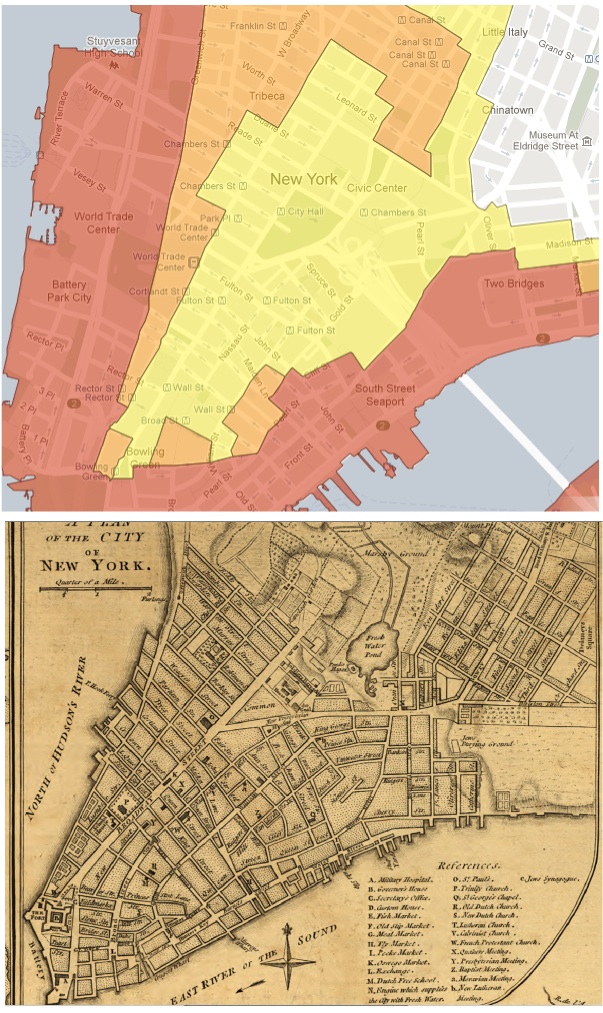
Now that the results of Hurricane Sandy have arrived, we can see by the map below that since 1776, the zone currently demarcated by the "Red Zone" (or Zone 1) is actually mostly landfill created over two centuries of development.
Makes you wonder what Sandy would have done to Manhattan 200 years ago:
It is interesting to compare the evacuation map to a 1776 map of the island before much of the coastline was augmented by landfill. The eastern line of Zone A along the Hudson River runs along Greenwich Street, which was at the waterfront in 1776. The old slips on the East River extend inland to Queen Street, now Pearl Street, which is near where Zone A runs along the East River.
Join the discussion: Comments (0)
| Email Link to a Friend
Permalink to post: http://www.cslproductions.org/earth/talk/archives/001361.shtml
Receive an email whenever this EARTH blog is updated: Subscribe Here!
Tags:
Permalink to post: http://www.cslproductions.org/earth/talk/archives/001361.shtml
Receive an email whenever this EARTH blog is updated: Subscribe Here!
Tags:
Add your comment
home | music | democracy | earth | money | projects | about | contact
![]() Site design by
Matthew Fries | ©
2003-23 Consilience Productions. All Rights Reserved.
Site design by
Matthew Fries | ©
2003-23 Consilience Productions. All Rights Reserved.
Consilience Productions, Inc. is a 501(c)(3) non-profit organization.
All contributions are fully tax deductible.


![]()